 Bob and I started our quest this morning. We left the house at about 08:00 and walked down the cutting from Tunnel House to the sawmill, just before Newland Station (now Station House). This was a beautiful avenue of trees, which I'm sure I'll see over and over again during the next few weeks. There was a tall, narrow building in a derelict state, but no way out onto the path behind, so we retraced out tracks and walked down the road to the station. The track ran just a few dozen yards north of the Newland to Redbrook road, so we tried to pick up the trail by heading over the fields, but found it was easiest to access from the afore mentioned road a little further down. The track was better than I could have imagined. We found signs of life in the form of a bench by a make shift barbeque and something that resembled mini buffers and then we came upon 3 or 4 caravans, smoke streaming from a chimney. We kept walking as the obligatory dog barked at us, but no sign of life. We ducked under the line of rags hanging out to dry across the path and we were gone.


peterdean.co.uk
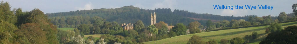
Newland to Wyesham

 Bob and I started our quest this morning. We left the house at about 08:00 and walked down the cutting from Tunnel House to the sawmill, just before Newland Station (now Station House). This was a beautiful avenue of trees, which I'm sure I'll see over and over again during the next few weeks. There was a tall, narrow building in a derelict state, but no way out onto the path behind, so we retraced out tracks and walked down the road to the station. The track ran just a few dozen yards north of the Newland to Redbrook road, so we tried to pick up the trail by heading over the fields, but found it was easiest to access from the afore mentioned road a little further down. The track was better than I could have imagined. We found signs of life in the form of a bench by a make shift barbeque and something that resembled mini buffers and then we came upon 3 or 4 caravans, smoke streaming from a chimney. We kept walking as the obligatory dog barked at us, but no sign of life. We ducked under the line of rags hanging out to dry across the path and we were gone.
 The path grew narrower, less like a railway track, but it was soon confirmed that all was well. We were on top of the bridge near Swan Pool. I'd been under it dozens of times and always stopped to admire the craftsmanship that went into these very large bridges. It seemed so small from on top, probably because it was overgrown with young trees and shrubs.
 The path opened out into a large track and when we checked the GPS we were heading off up towards Staunton. It was such a nice path that I was tempted to go, but we needed to get this leg done. I'd come back and do that walk another day. We shimmied down an embankment and entered a field. This looked like where the track had been. I went to look closer, but found I was sinking very rapidly in the mud. It was like quick sand, and I got out pretty quickly I can tell you. The mud was still well over the tops of my feet though. We moved quietly as I'm not sure we should have been there. We found the cutting again so knew we were in the right place.
 Then we spotted it, what we were looking for. The entrance to a tunnel. I had seen its photo, taken in 1980 on Geograph, but the co-ords were nowhere near here. As we approached with stealth, two dogs at a farm on the hill started wailing like banshees. This always happens just when you don't want it to as I've found out during my Trigpointing exploits. As we disappeared from sight at the bricked up entrance, they stopped. The door was very rusted, but the ground was higher than the door and it wasn't going to budge so we climbed the embankment to Offa's Dyke Path and looked for the other entrance. We found it much sooner than expected. The geograph said it was 264 yds long, but it was nowhere near that. This end was completely open, so along with my newest "must carry" accessory, a torch, we entered the tunnel. I measured it at about 60 yds. It was incredibly clean and tidy inside and obviously didn't get a lot of visitors. Tip: If you're taking pictures in a tunnel, hold your breath, otherwise you get a ghostly cloud across the scene. I've spoilt several photos in tunnels and caves by not realising this.
 The author of the geograph has now confirmed that this is Upper Redbrook Tunnel, measuring 66 yds. After re-emerging from the tunnel we soon had a slight detour as the undergrowth was just too thick, but after only three minutes we had found another tunnel. I love this project. The entrance had again been bricked and a barred gate was padlocked. But the lock was open! I could see immediately that this was a longer tunnel than the last one. Water dripped into puddles from the ceiling and junk was strewn inside. Actually it wasn't really strewn, it was piled up. Concrete ornamental wall blocks and polystyrene blocks, lots and lots of them, mostly neatly piled against the wall. I counted the paces off and after 150 began to hope that we could get out of the other end. After 260yds we were there and although it was bricked up, there was room to squeeze past a single barred door. I now know this is Lower Redbrook Tunnel. The length matches the description of the geograph almost exactly. Unlike the previous tunnel, which was straight, this had a bend in the middle taking it from south westerly to almost north westerly.
Many thanks to Billy for the update on the tunnels and the geograph.
 We were immediately on a lovely track through Lord's Grove. It was easy from here. No brambles, nettles or impassable sections, just a lovely straight pathway through the trees. I could see another possible track to my left just below me so I decided I would take that return route rather than my planned Offa's Dyke Path route. Beyond the track was the Redbrook to Monmouth road and next to that I could just about see the Wye through the trees.
 After a while the beautiful scenery turned to a dumping ground. A car had been ditched down a slope. Empty bottles, cans and litter were everywhere. Welcome to Wales. Welcome to Wyesham. I just don't understand why do people do this. It made the single crisp packet I'd picked up earlier seem a bit pointless, but that was all the rubbish I'd seen until now. I tried to figure out where the tracks would have been, as the area has been greatly developed in the last few decades. It would need to swing round to join up with the bridges, but that's for another day.
 I turned back and followed the lower track. I reckoned this track would have crossed the Wye at Redbrook and the other track would have taken the tunnels to Newland. When I got to Redbrook I was sent sharply down to the road. The OS map shows this to be the route of the track, but what was the sloping bridge across the road for then? We crossed back over the bridge to try to find where it joined up, but we found no easy answers and I will return. I'd walked down the path leading to Redbrook from the bridge dozens of times, but never gave it a thought that it was the old track. The were obviously works here as the stone ruins bear testament. This track must have taken a siding at least. It runs smoothly down to the Wye bridge and the corners are sharp, but not too sharp.
 Once in Redbrook we took French Lane home. This is a pretty direct route which goes straight over the top of the hill climbing 400 feet steadily. There was a huge steel water tank, with ladders to the top, which were locked off. But suddenly they have all been removed without a trace.
 Our first outing surpassed all expectations. We'd discovered two tunnels, walked the top of a bridge we'd never crossed before and most importantly found some fantastic new places to walk near our home. This jaunt was about 9 miles. In the afternoon we went down to Norchard Station on the Dean Forest Railway, which was open as they were having a steam day. We even stopped at Whitecroft as the train was waiting while they operated the level crossing, so we got out and watched. We got to Norchard before the train. I found a map of the Severn and Wye Lines, but not the Wye Valley Line. I called in at the specialist book shop in Coleford, but they're shut for a few days. The other shop in Lydney seems to have gone.