Home Blog
Tracing the Wye Valley and Forest of Dean railway tracks

Introduction
The Wye Valley Line from
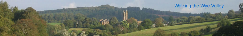
 Coleford to Newland once ran down the bottom of my garden, but that was long ago. There's no sign of the track now except for the sleepers which are being used for fencing, but the cutting is very clear and now acts as a driveway to a house. This is one of the many things which inspired me to trace and record the original tracks. Others include the tunnel at the Wye Valley Ghost Train geocache and the old bridge from Redbrook to Penallt, to name but a few. The local area comprised of the Wye Valley Line, the Severn and Wye Railway as well as the GWR Forest of Dean Branch and lines from Ross-on-Wye. These lines served local mines, works, quarries and passengers.

I must point out that I am not, and never have been a railway enthusiast. I approach this project from a mainly walking viewpoint, with some historic and architectural interest thrown in. I was the kid who had Scalextric and thought his brother's train set was really boring.

Ordinance survey Explorer maps show where some of the tracks lay, but the trail tails off in places. The first map I came across was this one, which came from urban75.org. It's very simplistic, and it's pretty clear that I'm going to need a lot more than this to guide me round the actual route, but it's a start.

The next resource I found was Vision of Britain. Here there are maps from the 1930's and as these railways operated from 1860's to 1960's this seemed a good resource. The detail's not great, so I don't plan to stop there. I mean to visit some local book shops as soon as possible in Coleford and Lydney and possibly the station shop on the reopened Dean Forest Railway at Norchard, which I seem to recall stock loads of train related books from my visits there with Will whilst visiting Thomas the Tank Engine a few years back.

I've now acquired a A3 Midland Railway Distance Diagram from 1917 and a huge map (1 inch:1 mile scale) of The Railways in Dean Forest from 1880. This also marks the tramlines, mines, works and collieries of the day.


Newland station gate

Newland Station is almost my next door neighbour, only Newland Tunnel is closer to my house. Both of the original level crossing gates are still in place and are an impressive sight as there is little memorabilia still in place.

SimpleMap


Blog

Newland signal box

Saturday 14th October 2006 Newland to Wyesham

Bob and I started our quest this morning. We left the house at about 08:00 and walked down the cutting from Tunnel House to the sawmill, just before Newland Station (now Station House). This was a beautiful avenue of trees, which I'm sure I'll see over and over again during the next few weeks. There was a tall, narrow building in a derelict state, but no way out onto the path behind, so we retraced out tracks and walked down the road to the station. The track ran just a few dozen yards north of the Newland to Redbrook road, so we tried to pick up the trail by heading over the fields, but found it was easiest to access from the afore mentioned road a little further down. The track was better than I could have imagined. We found signs of life in the form of a bench by a make shift barbeque and something that resembled mini buffers and then we came upon 3 or 4 caravans, smoke streaming from a chimney. We kept walking as the obligatory dog barked at us, but no sign of life. We ducked under the line of rags hanging out to dry across the path and we were gone.

The path grew narrower, less like a railway track, but it was soon confirmed that all was well. We were on top of the bridge near Swan Pool. I'd been under it dozens of times and always stopped to admire the craftsmanship that went into these very large bridges. It seemed so small from on top, probably because it was overgrown with young trees and shrubs.

The path opened out into a large track and when we checked the GPS we were heading off up towards Staunton. It was such a nice path that I was tempted to go, but we needed to get this leg done. I'd come back and do that walk another day. We shimmied down an embankment and entered a field. This looked like where the track had been. I went to look closer, but found I was sinking very rapidly in the mud. It was like quick sand, and I got out pretty quickly I can tell you. The mud was still well over the tops of my feet though. We moved quietly as I'm not sure we should have been there. We found the cutting again so knew we were in the right place.

Heading west

Inside Upper Redbrook Tunnel

Then we spotted it, what we were looking for. The entrance to a tunnel. I had seen its photo, taken in 1980 on Geograph, but the co-ords were nowhere near here. As we approached with stealth, two dogs at a farm on the hill started wailing like banshees. This always happens just when you don't want it to as I've found out during my Trigpointing exploits. As we disappeared from sight at the bricked up entrance, they stopped. The door was very rusted, but the ground was higher than the door and it wasn't going to budge so we climbed the embankment to Offa's Dyke Path and looked for the other entrance. We found it much sooner than expected. The geograph said it was 264 yds long, but it was nowhere near that. This end was completely open, so along with my newest "must carry" accessory, a torch, we entered the tunnel. I measured it at about 60 yds. It was incredibly clean and tidy inside and obviously didn't get a lot of visitors. Tip: If you're taking pictures in a tunnel, hold your breath, otherwise you get a ghostly cloud across the scene. I've spoilt several photos in tunnels and caves by not realising this.

The author of the geograph has now confirmed that this is Upper Redbrook Tunnel, measuring 66 yds. After re-emerging from the tunnel we soon had a slight detour as the undergrowth was just too thick, but after only three minutes we had found another tunnel. I love this project. The entrance had again been bricked and a barred gate was padlocked. But the lock was open! I could see immediately that this was a longer tunnel than the last one. Water dripped into puddles from the ceiling and junk was strewn inside. Actually it wasn't really strewn, it was piled up. Concrete ornamental wall blocks and polystyrene blocks, lots and lots of them, mostly neatly piled against the wall. I counted the paces off and after 150 began to hope that we could get out of the other end. After 260yds we were there and although it was bricked up, there was room to squeeze past a single barred door. I now know this is Lower Redbrook Tunnel. The length matches the description of the geograph almost exactly. Unlike the previous tunnel, which was straight, this had a bend in the middle taking it from south westerly to almost north westerly.
Many thanks to Billy for the update on the tunnels and the geograph.

Redbrook tunnel south entrance

Redbrook to Wyesham stretch

We were immediately on a lovely track through Lord's Grove. It was easy from here. No brambles, nettles or impassable sections, just a lovely straight pathway through the trees. I could see another possible track to my left just below me so I decided I would take that return route rather than my planned Offa's Dyke Path route. Beyond the track was the Redbrook to Monmouth road and next to that I could just about see the Wye through the trees.

After a while the beautiful scenery turned to a dumping ground. A car had been ditched down a slope. Empty bottles, cans and litter were everywhere. Welcome to Wales. Welcome to Wyesham. I just don't understand why do people do this. It made the single crisp packet I'd picked up earlier seem a bit pointless, but that was all the rubbish I'd seen until now. I tried to figure out where the tracks would have been, as the area has been greatly developed in the last few decades. It would need to swing round to join up with the bridges, but that's for another day.

I turned back and followed the lower track. I reckoned this track would have crossed the Wye at Redbrook and the other track would have taken the tunnels to Newland. When I got to Redbrook I was sent sharply down to the road. The OS map shows this to be the route of the track, but what was the sloping bridge across the road for then? We crossed back over the bridge to try to find where it joined up, but we found no easy answers and I will return. I'd walked down the path leading to Redbrook from the bridge dozens of times, but never gave it a thought that it was the old track. The were obviously works here as the stone ruins bear testament. This track must have taken a siding at least. It runs smoothly down to the Wye bridge and the corners are sharp, but not too sharp.

Once in Redbrook we took French Lane home. This is a pretty direct route which goes straight over the top of the hill climbing 400 feet steadily. There was a huge steel water tank, with ladders to the top, which were locked off. But suddenly they have all been removed without a trace. Cath told me she had to check she was in the right place when she first noticed this the other week.

Sloping bridge
Whitecroft

Our first outing surpassed all expectations. We'd discovered two tunnels, walked the top of a bridge we'd never crossed before and most importantly found some fantastic new places to walk near our home. This jaunt was about 9 miles. In the afternoon we went down to Norchard Station on the Dean Forest Railway, which was open as they were having a steam day. We even stopped at Whitecroft as the train was waiting while they operated the level crossing, so we got out and watched. We got to Norchard before the train. I found a map of the Severn and Wye Lines, but not the Wye Valley Line. I called in at the specialist book shop in Coleford, but they're shut for a few days. The other shop in Lydney seems to have gone.

We started at 001 in Newland and headed anti-clockwise. There's about another 1.5 miles up to Wyesham and back off the top left of the map.

Download the gpx file.

Today's route

Sunday 15th October 2006 Newland to Whitecliff

The section from the Burial Path to Bells Grove is being re-written at the request of the land owners.


GWR sleeper bolt

We headed back into Bircham Wood and picked up the track which led back to the starting bridge over the steep hill which the track detours around. I'd taken a stick with me today and when I got to the bridge I felt it knock on something solid. On further inspection I had discovered my first railway sleeper of the project. In fact there were a few here, with square GWR bolts too.


Whitecliff bridge

Not only were the sleepers camouflaged under the early autumn leaf fall, but the bridge was very camouflaged too. It was very overgrown and much higher than the stonework. Maybe some earth had been piled on it, as the vegetation seemed to thrive here.

When we got to the other side it was pretty difficult to pick up the trail. We went back and forth several times. I thought I'd found the track straight away, but a two foot ridge across the track made me wonder if this was right. In the end we decided it must be, and carried on. Besides, even the topo map had this marked as a path, though I can't imagine anyone had been down here for a very long time. We found ourselves in Whitecliff Quarry; no fences; no gates. The quarry (now a 4x4 centre) was deserted, so we quietly followed the line we had plotted for the track. The yard contains loads of relics, like old diggers, an ancient steam engine, a restaurant car awaiting reconstruction and many, many more.

We didn't hang around too long and soon found ourselves at the mouth of another small tunnel. This one was about 270 feet and really clean. A tiny section of rails was present, though the gauge seemed rather small, and some more rails lay outside. (See, I do know some railway terms). The rails were mounted on concrete blocks rather than wooden sleepers. The far end was partially blocked by corrugated iron and barbed wire, but was impassable. We zigzagged up the road to the quarry itself. I've often walked along the top to the Scowles, but it seemed even bigger from here. I'd managed to mark the far end of the tunnel on the GPS, so we navigated to that point, though it proved impossible to get there from where we were as we had climbed higher than we'd imagined. After half an hour of trying we decided to call it a day. We had been on the other side of the tunnel, or close by, a few times before and knew it was easy enough to get to.

Rails in the tunnel
Steam engine

Days Summary

Another great days tracking. We only did 5 miles today and uncovered rather less track than we had anticipated as we wanted to do all the way to Coleford, but the going was much harder today. At least we got a pretty difficult stretch under our belts. Again we discovered two tunnels and two bridges, one of which we knew nothing of. I had walked the section from Whitecliff bridge towards Newland once before, but had stopped well before reaching the new bridge. This was when I was first discovering the area.


Track notes

We started at 001, without really tracing any track, then drove to 002 and headed south doing the clockwise route then passed the car to do Whitecliff

The lowercase b on Tunnel3b denotes it is an estimate from map information rather than a marking by GPS.

I don't think I'll provide the gpx files until I've completed a section of track, then I'll supply it for the track only, cutting out my return routes and detours.

Today's route
Newland Street bridge

Sunday 22nd October 2006 Whitecliff to Milkwall via Coleford

We aptly parked up at the car park in Railway Drive, Coleford next to Coleford Junction station and traced our way back to Whitecliff. We walked through the council office's car park along an old high retaining wall. This was obviously were the track once lay, and sure enough at the end stood the bridge which crosses Newland Street. As expected it was securely fenced off, with new spike topped gates and razor wire. The top of the bridge itself was grass and had apparently been mowed as it was very tidy. We retraced our steps and then found a path by the bridge which took us up to the track. This was the most overgrown section yet. It was hard to tell where the line had been in some places as the trees had grown large in it's path during the last 90 years. After a while the track became apparent again.

We went past the Whitecliff furnace, which is being renovated at the moment and soon came to the Whitecliff Tunnel covered in corrugated iron. I had found this tunnel a few years ago and remember peering through the gaps to see an old train in the tunnel. There was no light at the other end then, so there must have been doors or similar. The rock walls to the west side of the track were high here. This section must have taken a lot of engineering. I may do a section on some of the industry that the railway was here to support. The furnace would be an ideal starting place as it is well documented as Robert Mushet is Coleford's most famous son.

Back at Coleford Junction, the signal box and a goods shed have been preserved and turned into a museum, with paraphernalia dotted around the yard along with a tiny gauge rail track, though I have never seen this in use. I guess the rest of the station has made way for the car park and shops, but it's good that something has remained and is obviously well cared for.

Coleford Junction signal box
Coleford - Milkwall cycle path

Crossing the B4228 takes you straight to the first of the tracks which has been converted to a cycle path. A Coleford sign on sleepers, stating the altitude, stands at the start of the track. These signs are used throughout the cycle tracks and I'm sure there will be photos at a later stage. We saw no bikes, but the path is well used by dog walkers. The area was impressively clean and tidy for a urban path. To the NE lies the Forest of Dean Golf Club and to the SW an industrial area including Mushet's Industrial Park. The track is straight and meets the road at a nice wooden gate in a miniature railway style with three sleepers inlaid in the tarmac. The signs are done in a cycle / railway theme.

We got back to the car just before the heavens opened as had been forecast.

I can't believe Garmin have an icon for a Seaplane Base, a bell(?) and even a pizza, but nothing for a railway station.

Track notes

The blue flags are where I had plotted the track prior to the walk. The detour away from the track is into the centre of Coleford, then back down Newland Street to get to the bridge from the other side of the locked gate.

OK was where I was definitely on the track and Track? was very overgrown, so I wasn't sure if it was right.

Today's stroll

Cycle path from Milkwall to Darkhill

Tuesday 24th October 2006 Milkwall to Point Quarry

A short easy stretch, as Sid and Will came along today. The cycle path continues past a home park and then into the forest. Trees are either side of the path and form an arch above. A stream runs along the east side, though the path doesn't really resemble a railway track here. A very pleasant stroll.

Darkhill Ironworks
 
A tribute to David and Robert Mushet

We reached Darkhill Ironworks. A display of mounted railway lines and plaque reading "David Mushet 1772 - 1847 and son Robert Forester Mushet 1811 - 1891. Outstanding Metallurgists. In this valley early experiments in the making of STEEL and its alloys were carried out. Thus the age of STEEL began." have been placed here by the Forest of Dean Local History Society. It is very pertinent that the first ever steel rails, used in 1857, where made here, as was the first Tungsten Steel.

After the ironworks you pass Darkhill on the other side of the track, then on to Fetter Hill. The track crosses the road here and obviously detours slightly to make a safe crossing. Soon after there are iron railway fence posts indicating we are on the actual railway line again, but very soon the railway track is off 20yds to the west of the cycle track. It drops well below and can be seen from above. We saw no real value in hacking our way through the undergrowth as we could see no objects of real interest. We did spot one fence post, which was the same as the one previously mentioned. By the time we had reached another of the nameplates at Point Quarry it was time for Sid to turn back, so we returned on the route around the back of the ironworks and through Gorsty Knoll on a beautiful autumn day.


Sunday 5th November 2006 New Fancy to Moseley Green Tunnel

No updates for a while as I've been walking in the Brecon Beacons over the last couple of weeks and doing a fair amount of geocaching too.

I parked up at New Fancy and headed east to pick up the railway track. I didn't realise that the cycle track here was a siding to the colliery until I got home and checked the map. I did remember seeing a railway sign up here a few years back, so I'll have to revisit soon. The main track is 1/3 mile east and runs next to the cycle path. It's reasonably clear where it runs, but as it crosses Fancy Road it's quite hard to follow as earth must have been dumped over the original track. We soon got back on track and stone walls on either side told us we were coming to the tunnel. Unfortunately it's another blocked off one, so we were forced to turn back. The door was very rusted, though the padlock looked pretty new. I didn't see any number painted by the entrance as I have with all of the others.

Moseley Green Tunnel North portal
 
Near Moseley Green

The sun streamed in through the trees as we retraced our steps, trying to find a better crossing of the road this time. Again, looking at the Midland Railway diagram now, we had discovered a siding, which ran parallel to the tunnel and about half way down it. We followed the cycle track past New Fancy and north towards Saintlow Inclosure. Vertical sleepers are standing either side of the path for most of this stretch. The track has been converted to cycle track right up to the Speech House from here, so it should be very easy going. We headed west and then south back to New Fancy car park hoping to pick up the siding, but missed it. I may even have the track logs from when I was there before, as I recall I had just got my first GPSr (a yellow Garmin eTrex) at the time. It may even have been the first time I ever used it.


Sunday 12th November 2006 Blaisdon - Longhope

Bob and I did the Flaxley to Longhope walk. This took in a good section of the disused railway. We picked up the track in an overgrown section by Blaisdon Wood. After 1/4 mile we came out into a beautifully manicured section covered in nice short lush grass. This was used to service a Severn Trent valve complex. It made great walking. We had to divert round a private driveway at one point, but we were straight back on the track. It was easy walking all the way to Longhope, though at one point I'm sure the track would have run at the bottom of some gardens, rather than on the track we were walking.

On the way north to Longhope
 
Cliff face by the Wye

Sunday 19th November 2006 Biblins Footbridge - Monmouth

At the footbridge there are two paths. There's the main cycle / footpath (though I don't ever recall seeing a bike on it) and there's another of a similar width a few yards further from the river. This second track is usually higher than the first, but not always. I don't know if there were two tracks, or if the cycle track was built at a later date. The other is slightly overgrown in places, but is easily passable at worst. I like this track as it's up close to the cliff faces and you get a real feeling of what it must have been like in the train rush past the rock a few feet from you, with trees on the other side and then the river only yards away.

We found the remnants of a building. There were about 8 large cylindrical containers embedded in the ground. I couldn't tell how deep they were as there was water in the bottom of all of them. I could see 6 - 8 feet down though. The site was once a quarry, but I don't know what the vats were for. If it was water for the trains I would have expected them to be higher so that they could feed via gravity. There were also a couple of small outbuildings nearby, but they looked to be of more recent origin.


The path veered away from the track briefly, but we managed to stay on the line, then we came to the end of the forest. There was now a field between us and the river and we were coming to the 90 degree bend before you get to Monmouth. The track went down the edge of the field and we followed it for a while until we thought there was nothing to benefit from this, and took the path next to it. The track is easy to follow and there were some great tracks and lanes. Eventually the track meets an industrial estate. In days past I guess goods would move between the rail and river here. Finally we came to May Hill where there was once a station. I could see no sign of this, but will return for a more in depth search.

There's a tiny section I need to do to join up this stretch and Wyesham.

Just before we left the forest
 
Old water tunnel

Sunday 26th November 2006 Biblins Footbridge - English Bicknor

We picked up from the footbridge again, but this time headed east. Again we had the two tracks to choose from and again some good cliffs in places. At one point a pool of fast running water was fenced off between the paths. There was no obvious place the water appeared from, so I assume it was underground, but there was an old stone tunnel for it to pass under the path nearest the river. This meant that this wasn't a new path and had been there for many decades. Maybe there had been two tracks after all. The river had risen dramatically over the last week. The current was strong and even this tributary was gushing powerfully.

The map is really unclear as to where the line ran once you get to Symonds Yat, but there's obviously a tunnel portal here, though I didn't see it. I didn't waste much time though as I can get the car close and come back for a hunt another day.


I took a detour from the track search and walked around Huntsham Hill. The map marked the exit portal reasonably well and as I walked down the rocky hillside I had a feeling it was below me, so we made a slight track back and found it easily. Unfortunately it was locked, but there were a few brick missing and we could see in at least. It's not the same as walking the tunnel, but it's better than nothing. There was a narrow entrance between the rocks and the rocks were high above the top of the tunnel. The track continued on along the bank on the river. The high cliff faces of Symonds Yat Rock, Coldwell Rocks and Ship Rock towered over us. We found a very old building under Ship Rock. It was about 16' square and about 3' high. It can't have been used for a long time as a mature tree was growing out of it.

Our journey was cut short as we approached Lord's Grove, but a heard of large cows with calves. We took no chances and left Welsh Bicknor bridge for another day. We've done it many time before, but have never been to look for the tunnel. I can't wait to get out there again.

Symonds Yat Tunnel (east)
 
Redbrook bridge

2nd December 2006 Redbrook - Brockweir

The old railway bridge in Redbrook sees a lot of traffic. Not from trains, but from pedestrians on their way to The Boat Inn for a drink or for a walk round Penallt or along the banks of the river. The footpath was tagged on the side of the bridge when the tracks were ripped up in around 1960. The bridge should soon see a £200,000 investment, not to see it upgraded, but just to keep it in a safe, usable state. Once over the bridge you're in Wales. The track lies between the road and the path at the rivers edge. It stays a few metres from the river all the way down to Tintern. The first half of the stretch to Bigsweir is a well maintained path with forests to the west and open space to the River Wye to the east. The Forestry Commission are managing the land. After a while the track comes to an abrupt end by a house. The route veers over a field. Strangely, there's still a slight trail where the track lay until it meets the fields boundary. A barbed wire fence in a poor state is no deterrent to a tracker and on the other side the track was again clear.


The track was fenced from the adjoining fields, yet sheep grazed along the track. There was an old bridge with stone sides over a stream which lead to the river and plenty of sleepers as usual. The final stretch opened into a field and a gate with barbed wire wrapped around it told us that maybe we weren't supposed to be here. Near the gate stood an 8' post with a bent sign which could not be read. I'm not sure if it had anything to do with the railway or not.

We crossed the road by Bigsweir Bridge and hopped a fence. This looked like it was owned by a fishing outfit, so there was nobody in sight at this time of year. An old shed, with doors raised from the ground stood close by, but still no sign of the tracks. A gate brought us into common land and another place we had been before. The track is on a raised piece of land surrounded by crops and after a while the track becomes more evident, but is fenced in. We'd somehow found ourselves on this fenced in area once before, but we negotiated the fence and strolled comfortably until we reached the farm at the end.

Bigsweir shed
 
Brockweir

Bob scrambled though a gap while I climbed a gate trying not to draw attention from the farmers wife who was walking around the garden. We soon made it down the side of the church and picked up a footpath, but the track was across a field again. We could see it soon lead to a dead end, but we were determined to walk as much of the track as we could so hopped a fence, walked the field and then came back again. We had to circumnavigate the field to join it on the other side of the fence. The next small stretch was again a lovely maintained path, but all too soon we were at a dead end. We found ourselves on a well defined track with adjoining grazing fields. Despite a nearby farm all went well until the track became less distinct and then met a fence and turned into a jungle. We walked along the road for a short while, as the track did run very close to this road in it's day. When we met Brockweir Bridge (1906) we crossed the bridge and turned back. See the BLOG.

This stretch of track measured approximately 7 miles.


3rd December 2006 Saintlow Inclosure - The Dilke - Cinderford - Ruspidge - Upper Soudley

There are two bridges very close together at Saintlow Inclosure. They carry the track over wet land below, but I couldn't see why they had been built. There must have been a good reason to go to all that trouble. The track is a cycle path now though is also home to walkers, joggers and today a pack of llamas and a horse. After detouring round the saw mill we came to Lightmoor Colliery. This must have been a lovely building in it's day. It looked pretty sturdy even now despite the lack of windows and only the bare bones of a roof. The premises are still busy, but this whole area must have buzzed with industry a hundred years ago. The previous night had been very windy and a tree was down over the path and would have been impassable to a train. I wondered if these shallow rooted fir trees were here back then, but as I passed Spruce Ride I decided they probably were.

Lightmoor Colliery
 
Dilke Bridge

I'd driven over Dilke Bridge hundreds of times without realizing it was indeed a bridge over the old railway line. The bridge is very similar in construction to Central Bridge where we started out today. It's all stone with a low wall along the top of the bridge. We carried on north along the well defined path until it left the original track. for 1/4 mile. We stayed with the track which we extremely muddy. Some heavy machinery had been working around here and the ground was black mush. It struck me as odd when we visited Crabtree Hill Trig Point a couple of months ago that this was very flat for a trig point and completely surrounded by trees, so no line of sight could be seen to other trig points (which is the whole point of them). So these trees can't have been here when the trig was built probably in the 1930's. A nice easy stroll to the end of the Mineral loop Line at the Drybrook Road junction. We turned right and headed towards Cinderford. This town is the most industrialized in the forest and has to be my least favourite place in the area, but I guess it does have an industrial history and there were quite a maze of lines around here once.


Half way down this section we found a siding to the south. A couple of pieces of railway debris lay about. Old rotten metal cans and baths seem to be quite easy to find. We followed the Main Line for only 0.6 miles in total until we reached The Forest of Dean Branch and headed south, initially taking the wrong path. The track itself stood perched on a ridge between trees. Some trees looked too old to have grown since the railway went, but this was definitely the track. The woods soon open to and industrial area and we found what I believe was Letcher's Bridge. There were the what looked like the stone sides of a bridge with the top part missing and a large pipe running in its place. Shortly afterwards is an information board relating to Bilson Halt. The path was wide here.

There are a series of ponds to the east of the track in Linear Park, which would be a nice place to visit if not for the factories. We walked in the rain past the site of Cinderford Ironworks. This place provided heavy industry from 1795 to 1894. The tramways would have served the works for most of its life, not the railways.

Ruspidge Halt
 
Truck at Ruspidge Halt

Ruspidge Halt has been preserved, although there's not a huge amount there. A sign and two benches sit above the retaining wall on one side of the track and a signal and a truck on a fenced off section of track on the other side. It's great to see the first signs of preservation on my wanderings. After such a good section we crossed the B4226 and our luck immediately changed. The area is right on the edge of the forest and is built up. The track went straight into private property. We followed alongside the track in the edge of the forest, but we were climbing well above the track. Now we were stuck on the wrong side of a stream which was well and truly a river at the moment. With slight back tracking we crossed an overgrown bridge and made it down into a locked up paddock and climbed over a high corrugated iron clad gate to get back to the road. Sections here were private / semi-private, but we followed the track where possible until we got to Ruspidge Goods Yard and the track went back into the forest by a large stone marking The Blue Rock Trail. The track followed Cinderford Brook crossing it at times via bridges. We passed a disused quarry, then came to what looked like Staple Edge Halt, which is marked by a bench, though there is no halt reference.


The last place of interest for the day soon followed. At last we had found a tunnel. OK, so it was a small tunnel and it was blocked at both ends without even a door, but it was a tunnel. I couldn't figure out why it was here though. It was right at the edge of a steep hill and it should have been no problem for the track to detour round the hill. The bend wasn't too sharp. But there must have been a very good reason as this would have take a huge effort to build. Very close by is a memorial to the 5,000 sheep culled in the forest in the 2001 foot and mouth epidemic and also a picnic table and a wooden sculpture of a miner lying on a trolley.

This was the end of our trail for today. We had completed 7 miles of track today. This weekend had seen 14 miles of track and 25 miles walked in total. Bob had had a ball. Let's just hope the weather holds out for the next few weekends.

Staple Edge Tunnel
 

Nailbridge

21st December 2006 Nailbridge - Drybrook - Lea

At 10:00 we parked up in the church car park in Quarry Hill, Nailbridge. As we walked the few yards to where the tracks would have run under the road it was easy to see that this would have been quite an industrial area. To the north the line ran up through what is now Hale's timber yards. and came out of the rear of the property via a bridge that carried the road above. A well worn track and a broken fence saw us stay on course until a farmer came to remind us that this was not a public right of way. We played dumb and engaged him in a chat about the railway. He was a pleasant enough chap, but was too young to give me any information. He was under the impression that the track ran further down the field as there was a visible line there, but this was wrong as all the maps showed. We found the nearest road via a wooden track / bridge which crossed a bog. Bob got a shock when he ran through the wet grass and found he was up to his neck in water. This was the beginning of today's struggle to stay on the track. We passed a house called Harry Hill View.


We had to follow the roads of Drybrook before coming to the point where we met up with the track again. Another bridge saw the exit of the field, with the track several yards below, but the other side of the bridge was raised. I don't think there's a tunnel here. Maybe the land has been filled. A house was being built directly above where the track would have been. The field was being worked by two hands, so I'll have to check back another day. At last we found the railway cutting next to a public footpath. We didn't have to follow it for too long before coming to Drybrook Tunnel. It looked open, then as you get closer you realize that there's a brick wall 50 feet into the tunnel. Someone had tried to force open the iron door, but to no avail. Pieces of industrial junk lay around. We'd plotted the point where the north portal lay, which was thankfully in the forest, so we set off to find it. You need to be a little careful when approaching the tunnel as you may find yourself dropping from above the entrance if you're not on the ball.

From stone to brick
 
Trucks

The woods here are very beautiful and I can't imagine they are used much. The wall lay 50 feet into the tunnel again, but this time the door was open. After changing the torch batteries we set off into the tunnel. It's the first tunnel where I've noticed a distinct incline. As is often the case, some sections are brick lined and then there's a rock section. Most of the floor had been covered with a smooth concrete layer, making walking very easy. A 10 foot room could be entered in the middle of the tunnel via a small arched doorway. As we go close to the end there were narrow gauge tracks with some decrepit old trucks. This definitely wasn't the original track. There was also cable, pots and machinery, but it was pretty tidy on the whole. By the time we'd walked back to the north portal we'd walked a mile underground. We stopped for a drink and enjoyed the peace. Heading north we had a nice easy stretch through forest. It didn't last long though, and we found ourselves climbing through brambles and trees. We walked sections alongside the track as it was such hard work. The track itself stood on a raised ridge.


Things cleared again and the now well defined path passed under a diagonal stone bridge and then on to an area with loads of railway paraphernalia. The first thing I noticed was a good section of track. This has been pretty hard to find until now. There were a number of wagons, trucks and piled up sleepers too. Last, but not least was what appeared to be a tunnel entrance, though it wasn't facing the direction of the track. Two doors securely barred my entrance. Inside was no more than a small cave, presumably used for storage of trucks, as the rails ran into the cavern. We pressed on. A garage stood between us and where were needed to go, but we were on raised ground and it's corrugated roof was at floor level. A reinforced pathway had been constructed, so I crossed carefully, though Bob just ran across. I had visions of him crashing through the roof, but he's pretty light fortunately. The farm house was very close, but the fog gave good cover and we felt quite safe. After the next field we were forced down the back of gardens to a point where we could go no further without attracting attention. Besides, a gaggle of geese were making a real racket. You've got to know when to quit.

Rails at last
 
Hidden from view

We hopped another fence and got back onto the road, which passed between two sides of a bridge. The top was no longer there. A Forest of Dean boundary stone stood in the garden next to the bridge. The track went through a farm, so we stuck to the road until we got to a public footpath and crossed a field to meet the track once more. This was the junction where the line went west to Ross and east to Gloucester. We hadn't planned going west here, but the cutting was so nice that we walked it for a while. Well, about a field or twos length until it climbed back up to the level of the surrounding land and became nothing special. In this short stretch there was another lovely bridge with a shallow arch passing over the track. We retraced our steps to the junction and climbed a fence into an unused thicket to the side of the field. Most of tracks we've come across have nothing at all growing where they stood, but this stretch was totally overgrown. We had a really tough job getting through, but we knew there would be a fair amount of track round here that we wouldn't be able to follow, so we had to make the most of any bits that were possible.


A short stretch of field, followed by a muddy path revealed cows blocked the way to a few new houses. We were pretty sure we would not get past the houses so went back to the road. After a fair diversion we arrived at the other side of the houses. A building was signed Lea Station. No way through was possible. This was becoming a pain. The problem was that we were out of the forest and the land was open, private and arable. We decided to just enjoy the next couple of miles and forget about the track. I sat on a stile on the edge of a wood to eat lunch. You couldn't see half way across the field due to the fog. It was strangely peaceful. I think I would like to have lived in the days when these railways still ran. The world must have been a quieter, slower, more relaxed place.
We crossed the A40 near Lynors Farm and picked up the scent once more. We were looking for a tunnel entrance as we came down the edge of the hill. We found it alright, but the steep embankments made it hard to get down there. We had to be careful as there was a house nearby too. The portal was completely open, with no attempt to block it. We hadn't seen many of these.

Lea Tunnel east portal
 
Wet tunnel

This was the wettest tunnel we had encountered. The floor of the east half was mostly covered in water, though you could generally dodge the water. I had good boots on as always, so it wasn't a problem. The other unusual thing about this tunnel was that it was perfectly straight. You could see the daylight at the other end, even though it was mainly blocked. This gave the impression that it was shorter than it really was. In fact it was very close to 0.5 miles long. Air bricks let in light at the westerly end, but several had been removed and were only blocked by a few piled up rocks. We could have emerged, but it was getting dark and we had a long way to go to get home. The GPS had already gone beep as it picked up the satellite signal through the wall, but I stuck it through the gap to get a more accurate reading. We walked back via the light of the mini maglite, for what would be the last time as it turned out that I'd got a cool Petzl head torch for Christmas. We had fun scrambling up the embankment. At first we just kept sliding back down, so had to find an easier route. We climbed up, found our way back to the road and completed the 16 mile journey down the Wysis Way in the fog, then darkness. Great fun, but hard work.


24th December 2006 Brockweir - Tintern Quarry

I parked up at Brockweir on another misty day and walked Offa's Dyke Path, past the Devil's Pulpit, with it's excellent view down to Tintern Abbey. It's a good climb and there are few views due to the trees, but it made a great circular route to the most southerly point of today's track expedition. My route from Offa's Dyke Path to the track was scuppered by a path marked on the map not existing, so I diverted down the subsided quarry road that zigzagged down the steep hillside towards the River Wye. Our way was blocked by a disused quarry two storey building with a large sign reading Get out now. Bob went too close to the building and a container next to it and a recorded message belted out over a tanoy. Move away from the building. Alarms have been triggered. We contemplated going back, but just carried on in the end as we didn't fancy climbing up the hill again. We found the track immediately as there were again rails still in place. I didn't realize that this is the spot I had visited on a geocache. It looked different approaching from this direction.

Tintern from The Devil's Pulpit
 
Subsided road

We headed north, back towards Tintern. Sleepers and rails were intact for a while, first the rails disappeared, then the sleepers. I don't know why they were left here. There's a lot of wood and steel. The path was really pleasant and easy. I was surprised at how steeply the track climbed here. We were about 170 feet above the river. The path was obviously well walked and came out by the river, opposite the ruins of Tintern Abbey. I got a great surprise as there was another tunnel. I didn't know that this one existed. If I had studied the contours on the map it would have been obvious, but I guess I had originally thought that the railway crossed on the bridge at Tintern. This was wrong. The bridge where it did cross no longer existed. It must have crossed the river and then gone straight into the tunnel. So far I've seen most tunnels bricked up with a door built into the brick wall, or no attempt to deny access, but this portal had a pair of 7' iron gates. They looked as if they would be no problem to scale, but I wasn't sure it was a good idea to take Bob on this one and it was getting dark again. I didn't want to cross the river, so found a route to near where the tunnel emerged by the river.


We couldn't get down to the tunnel and weren't that bothered as I can't imagine the tunnel will be blocked at that end. We could have crossed the river and traced the missing piece of track between Brockweir and Tintern, but that should be an easy bit to do another day, besides, the preserved Tintern Station lies in this stretch and light wasn't good enough to take photos. I could see the station across the river with it's large sign proclaiming the station name. We wandered back down the riverbank and past the HAPPA centre to where we'd parked up. This had been a really nice walk, though we hadn't covered a great deal of track.

The bridge at Tintern. This is not a railway bridge
 
Tunnel under the track

26th December 2006 Tintern Quarry - Tidenham Tunnel

We'd walked this section before, so Will came with me to stretch his legs after the Christmas excesses. He had loved the story about the quarry alarm and I had to convince him it wasn't a good idea to do it again. We picked up from where we'd left off, though this time we came from the direction we knew. We passed under our start point via a small 65 metre tunnel. The sleepers and rails ran for the full length of today's section. This path must be much less utilized than then stretch up to Tintern as it was a little overgrown in places. It passes very close to the quarry building. This stretch is below the subsided road and a lot of rock has tumbled onto the track. There's a buffer here and a couple of old stone ruins. The track runs very close to a very steep drop in places so care is needed. We also found a small cave which we hadn't noticed before.


It's a brilliant tunnel. Not barricaded at either end. It's probably the longest tunnel I've been down as it clocks in at almost 0.75 miles. It's only unusual feature is that there is a shaft to the surface in the middle of the tunnel. You can turn your torch off here and see OK. The Petzel MYO5 torch got a good workout. It's incredibly bright on the xenon beam, but the led mode is great for walking as it lights the ground around you and lasts for up to 70 hours in this mode. I tried on Christmas day walking over the fields in the evening. Never again will I be constrained to walking in daylight hours only.
Will really enjoyed then tunnel, he thought it was a great adventure. At the south easterly portal we scrambled up the bank. The track is very overgrown here, so I'm not relishing the thought of this short section. There's a bridge just a few yards from the tunnel portal which seems odd. We walked back via the Gloucestershire Way. There's just one field where the owners have done their best to conceal the public right of way. How annoying is that?

Will in the middle of Tidenham Tunnel
 
A very high River Wye

2nd January 2007 English Bicknor - Coppet Hill Tunnel

I started the New Year in the same way I'd left the old one - in the company of my young helper, Will. It was the last day off before going back to work. The weather had been pretty bad recently, so we decided to make the most of our last day anyway. I parked by the old HW Smith/Reed/SCA factory near Lydbrook. We walked over the railway bridge to investigate the tunnel first. After stopping at the pill box (which is open) we found that the breeze blocks at the south portal had been demolished. The tunnel was very wet indeed. There were several inches of water for as far as you could see with a torch. We had a couple of miles of track to the west to trace, so we left the tunnel for now. We'd wanted to get to the tunnel on 26/11/2006, but were forced back by cows, so we went to meet the point where we'd got to. The factory has been closed for three years now, and is beginning to look pretty derelict. The line looked like it ran right up to the building. There was a signal pylon left in place. The whole place was fenced and locked, so we traced the perimeter.


No cows today and just one detour into a fenced narrow strip where the track ran, otherwise the track ran on public paths. We followed the main path closer to the river back to the starting point. I'd been researching Lydbrook Viaduct the previous night, so we had quick look to see if we could see the stone anchor points on the way past in the car. The west side was easily visible. After lunch we parked up at Kerne Bridge and went to look for the other tunnel portal. The track didn't cross this bridge, however the bridge it did cross half a mile downstream was no longer in existence. We walked to this point and then picked up the track quite easily. A lone house stands by the side of the track here. Another half a mile and we were at the tunnel. Once again it looked like a JCB had been used to knock a significant hole in the blocked entrance. The cross section of the tunnel was much taller than the others I'd seen and was quite egg-shaped. This end was dry. Well as dry as anywhere can be at the moment. We walked the length of the tunnel and found it was only the last 30 yds that were submerged, so didn't bother to wade through the water. Instead we turned back and walked the length of the tunnel again, which turned out to be about 1/3 mile.

The line ran next to the packaging factory. It made cables then.
 
Coppet Hill Tunnel south. Pill box is in the shot.

Will's getting pretty good at tunnels now, especially if he gets to wear the head torch. The photographs give a very false impression as the flash lights them well. They are, of course, pitch dark for most of their length. As usual, this was not a straight tunnel, so became dark very quickly. For most of it's length it's walls were composed of medium sized stones and a narrow section of brick work ran in a strip along the ceiling. We'd looked for the air shafts, which were marked on the map, near the south portal, but could see nothing. We emerged once more back onto the muddy track. Once we again reached the point where the bridge once existed we had a better look to see where it joined the other bank, but though there was an obvious base on this side, nothing could be seen on the other side. It must have been quite a long bridge too as it crossed the river at a shallow angle. I'm sure we'll investigate this more very soon.


March - June 2007 Lydbrook Viaduct

I've walked this short stretch many times from the railway bridge at Welsh Bicknor to up past the viaduct at Lydbrook. There are plenty of photos of the viaduct on the Internet, especially of it being decommissioned in 1965. It stood 90 feet above the road and was an impressive sight, or so I believe from the photos I've seen. The arches are no longer there, but I did find the point where the viaduct left the ground at both ends. The eastern end is very simple to find as it is right by a public footpath, but the western end is altogether harder to find. Having said that, if you walk down the old cutting, despite being somewhat rugged, it can easily be found. Otherwise a fence will come between you and it.

I carried on walking up the track until we came to a stretch which was a private driveway. There were some interesting steps, walls and retaining walls along the way as if there had possibly been a station here at one point.

 
Lydbrook Viaduct
 

17th June 2007 Meiry Stock

One of the reasons I've not walked a lot of track in the last 6 months is that much of what is left is cycle track and it really doesn't interest me that much. For an easy Sunday stroll I was accompanied by Will on his bike. We parked a mile south of Meiry Stock Tunnel and tried to follow the overgrown path that would have been the Speculation Siding. It was hard work with a bike and there was very little to see. As we joined the main line we soon came to a lovely bridge, just standing in the middle of the forest. As we stood on the bridge we could see the tunnel a couple of hundred feet in front of us. It's an oval portal which has been bricked, with a steel barred gate. One bar of the gate has been removed, but there's no way I could fit through and it looks very muddy in there. The spelling is interesting as the buffer/sleeper nameplate states Mierystock Tunnel and Mirystock Bridge, whilst old maps are marked Miery Stock Tunnel. Mind you, there's a new road sign at May Hill that says Mitchel Dean. It's Mitcheldean if you don't know.

Miery Stock Tunnel from Mireystock Bridge
 
Meiry Stock Tunnel north portal is buried

The north portal is on the other side of the A4136 (Monmouth to Gloucester road). It's a sad sight as it's been covered over with earth. There is an unimpressive FC sign which I've quoted below. Note yet another spelling of the name. The inscription on the key stone reads A-D 1874. I believe a bunch of locals tried to clear the tunnel entrance using a JCB a few years back so that their kids could safely cross the busy road on their bikes, but the move was thwarted. As you can imagine, nothing exists of the railway here as everything has 30 feet of earth piled on top of it.

We returned the way we had come, but then ignored the siding and stuck to the main line which took us up to Drybrook Road Junction. It's cycle track all the way, though there are plenty of relics about. Sleepers stand vertically for pretty much all of the route and there's a long bridge on the way too, though it's not the prettiest I've seen. We neared Whitegates Junction an then returned home.


Mireystock (Mierystock) Tunnel
The engineering company J.E. Billups of Cardiff who also constructed Mireystock Bridge and the masonry work on the Lydbrook viaduct commenced construction of the tunnel in 1872 using forest stone. The tunnel is 221 metres in length and took 2 years to construct. The tunnel allowed the connection of the Severn and Wye Valley railway running from Lydney with the Ross and Monmouth network at Lydbrook. The first mineral train passed through the tunnel on 16 August 1874. Passenger services commenced in September 1875 pulled by the engine Robin Hood.

The history of this section of line is not without incident - a railway ganger was killed in the tunnel by a train in 1893 and a locomotive was derailed by a fallen block of stone in the cutting at the northern entrance in 1898.

The line officially closed to passenger trains in July 1929 but goods trains continued to use the line until the closure of Arthur & Edward Colliery at Waterloo in 1959 and Cannop Colliery in 1960. Lifting of the track was completed in 1962. The tunnel and cutting were buried with spoil in the early 1970's.

Thanks to the vision and enthusiasm of a group of local Forest railway enthusiasts assisted by Forest Enterprise the top of the northern portal of the tunnel (with its unusual elliptical shape) which has lain buried for 30 years has now been exposed.


22nd June 2007 Tintern Tunnel

I needed to come on my own to do this tunnel, as there's a 7' gate blocking the entrance so Bob and Will couldn't get in. It's incredibly dry in the tunnel despite colossal amounts of rain recently. There are bricked arches for pretty much the whole of the 200yds of the tunnel, each having the raw rock protruding through. Almost as soon as you're in you are far enough round the bend to see daylight from the far end flooding in from above the breeze block wall. An iron door stands in this wall. It doesn't appear to have any kind of a lock. The tunnel emerges from the rocky hillside about 30 yds from the river. A couple of stone pillars stand here and the footings of the bridge are very clear on the other side of the Wye.

There's been a lot of talk about reopening this section of the line for a national cycle route. This would mean reopening the tunnel and rebuilding the bridge. I can't see it ever happening as the costs would be astronomical.

Arches inside Tintern Tunnel
 
Unveiled Mierystock Tunnel North portal

2nd December 2007 Mierystock Tunnel Uncovered

You can drive down the same bit of road hundreds of times and not appreciate what's around you, and that's exactly what happened here until June 2007 when I realised I was driving over this tunnel. So when a Big Lottery Fund notice board appeared here in November my hopes were immediately raised. Then one day I spotted several large JCB's near the tunnel entrance. Work was being carried out at an alarming rate and with some Internet research I found that the project to reopen the tunnel for cycle traffic had been granted £58,000 in Nov 2006. After the tunnel entrance had been cleared and huge amounts of earth moved, the diggers disappeared and the sign went too. I can only assume that the project has been abandoned, though finding any information is proving very difficult. Please contact me if you know anything about this.

We carried on along the track to meet the point we had walked down to from Lydbrook. There was evidence of an old bridge and the walk was very enjoyable.

Compare the picture with the one above it of the same portal.


9th December 2007 Point Quarry - Cannop Pond

Point Quarry is a fascinating place. There is clear evidence of where the sidings ran into the quarry, with rugged stone walls, some stones show engraved lettering. Trees grow where the line would have lain and the steep walls of the quarry are quiet austere. As we followed the path we noticed a stone structure to our right and hopped the fence to take a look. A beautiful, short tunnel was completely open at both ends. It was only 20 yards long or so, but the exit into the stone walled cutting was fantastic. I wonder how many people have walked over this not knowing it was there. This was very much the highlight of this excursion though. With cycle track for most of the way apart from a section through Parkend. We passed a sign here commemorating the planting of a row of Lime trees by Edward VII. After passing Coleford Junction we soon reached Cannop Wharf and after a walk alongside the pond we were back to where we had left the car.

Point Quarry tunnel
 
Bridge remains at Hagloe

2nd February 2008 Upper Soudley - Bullo and Awre - Mallards Pike Lake
I did these two sections of the FOD Branch and the FOD Central Railway as a circular walk. Starting at Upper Soudley some houses had been built over the track. I soon picked it up again and entered the forest by the FOD Visitor Centre and found the west portal of ********* tunnel to be sadly bricked up. This was to be the theme of a disappointing day with regard to my findings as all portals today were closed. As we approached Lower Soudley we found the other end of the tunnel next to the road by Bradley Hill. Standing in one spot I could see the exit from one tunnel an the entrance to the next. There was a great deal of evidence of an industrial past here, but as we were forced at right angles away from the track we entered Glastonbury Wood and climbed Fernbrake Hill above the tunnel. The OS map is pretty unclear as to whether the track emerges briefly after 1/3 mile of not, so we had to go and find out. The plus side was that we found a nice viewpoint on the hill looking over the River Severn, but no portals. Oddly we did find a stretch which looked very much as if it may have carried a railway line and even the altitude was roughly correct. It definitely went nowhere though.


We were forced to detour massively or cross a field, so we took the latter option only to find a Trespassers will be Prosecuted sign as we exited the field. We soon reached the last portal of the day which was set it an impressive cutting into sandstone. We decided not to walk down the boggy cutting but picked up the track at Grove Farm. We followed the track until we got to Bullo Farm and then detoured along a path to Bullo. This is where the line would have joined The Great Western owned line to Gloucester and is the easterly point of my journey, so I picked up the Severn Way and walked an area I know quite well through Awre and down to Little Box to pick up the line again. We walked up to the partially missing bridge, but could see it was not feasible to follow the track so walked along the road with a close eye on the track. We were pleased to get back on the track after Poulton Farm as we had walked precious little track so far that day. Another bridge marked the start of the path, though we had noticed a more interesting structure slightly earlier. Maybe one day I'll revisit and get a closer look.

Viaduct at Nibley
 
Kiln

I think our attitude must have changed towards this project as we took a more interesting path rather than follow the track along the back of some houses at Blakeney. We crossed the A48 and again had to miss a big section as it was on private land. The bridge and viaduct at Clarks Lane must be one of the most interesting remnants of the railway. I'd love to get on top of it, but there was no way today. It wasn't until we got back into the forest that we managed to get back on the track properly and even then we couldn't follow it when we got to Copes Quarry. Just before that we found a beautiful kiln near Fowlswell Slade. We followed the railway quite easily all the way to Mallards Pike Lake spotting some lovely bridges and absailers along the way. A quick climb back over the hill to Upper Soudley and we were done. A great days walking, though our most poorly followed stretch of track so far by a long way.

3rd July 2008 Tunnel News

Three pieces of tunnel news have come to my attention recently.

  • Sustrans are apparently on the verge of finally agreeing the conversion of the track from Chepstow to Brockweir. This will mean good and bad news. Tiddenham Tunnel will have low level lighting and presumably have its track removed. Hopefully the line to the south of the tunnel will become navigable. Tintern Tunnel will be opened, and most significantly of all, a new footbridge will span the Wye at the tunnel entrance, where the railway bridge one stood.

  • After scouring the Internet for information of Mireystock Tunnel, a front page article in the FoD Review about a man who's dog broke it's leg falling down the embankment revealed that the £50,000 of lottery funding has been spent. The plan is now to wait 18 months for the cutting to heal over before the next stage, which is to "hopefully open the tunnel to the public". I don't like the use of the word "hopefully".

  • The owner of the Euroclydon Tunnel wants to change its usage to some sort exhibition centre. Public objections seem to be strong, and it looks very unlikely to go ahead. It was registered as a mushroom farm, though there was no sign of any farm when I was there recently. The owners also own Clearwell Caves.

  • Additional (2008/09/14). Tiddenham Tunnel has been sealed (railings) at the northern portal. I believe the southern portal has a temporary fence, but this may now have been upgraded.
27th September 2008 Severn Railway Bridge and Tunnel

We started off by visiting a real white elephant. The three arched viaduct at Purton was built as part of the Purton Steam Carriage Road, to link the forest's industry to the River Severn. Unfortunately the plans were scrapped in Parliament before things ever got really underway. The viaduct, having been already built, was never used. Today it is in a poor state of repair relying mainly on local enthusiasts. The council have categorised it as risk category 3. It can be found at SO 67065 04900.

We then tried to find any evidence of the Severn Railway Bridge, which was decommissioned in 1969 after being struck by colliding ships in 1960. There are some photos from this period here. Much of the bridge was shipped to Chile and used to build a new bridge. There is little remaining of the bridge these days. We did manage to find a few large pieces of masonry in the undergrowth, but nothing very impressive. As you follow the lane south from the bridge there is a treat in the way of a lovely bridge that I wasn't expecting, though no sign of the station.

Purton viaduct
 
Severn Bridge Tunnel

The tunnel is not on a public right of way and like so many disused railways the land is used for raising game birds. The track bed is very muddy and not a pleasant walk. The tunnel was interesting as it is the only tunnel I have come across in the area wide enough for two tracks. This fact coupled with the perfect straightness of the tunnel meant that it was pretty light throughout the 506yds despite it being dusk. If it had not been for the large puddles I would not have needed a torch at all. I spent a couple of hours walking down the track and through nearby fields. Part of the reason was that the paths marked on the OS map just didn't seem to exist. There's a nice ruin on the brow of the hill at Warren and the sunset was wonderful. The track came to an abrupt end at Warren Grove and I didn't feel any compulsion to hack through brambles just to walk a short section to Lydney. I will probably re-visit it again from Lydney Harbour at some stage. I find it fascinating that the village on either side of the river Severn is called Purton.


Copyright © 2008 Peter Dean. All rights reserved.