 I started the New Year in the same way I'd left the old one - in the company of my young helper, Will. It was the last day off before going back to work. The weather had been pretty bad recently, so we decided to make the most of our last day anyway. I parked by the old HW Smith/Reed/SCA factory near Lydbrook. We walked over the railway bridge to investigate the tunnel first. After stopping at the pill box (which is open) we found that the breeze blocks at the south portal had been demolished. The tunnel was very wet indeed. There were several inches of water for as far as you could see with a torch. We had a couple of miles of track to the west to trace, so we left the tunnel for now. We'd wanted to get to the tunnel on 26/11/2006, but were forced back by cows, so we went to meet the point where we'd got to. The factory has been closed for three years now, and is beginning to look pretty derelict. The line looked like it ran right up to the building. There was a signal pylon left in place. The whole place was fenced and locked, so we traced the perimeter.


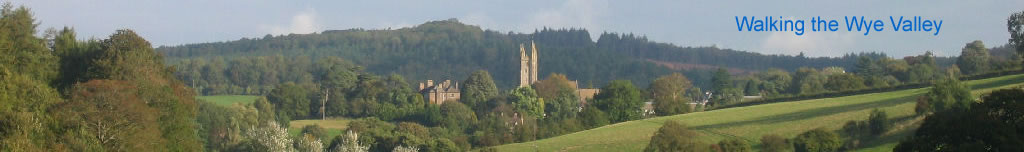
peterdean.co.uk
English Bicknor - Coppet Hill Tunnel

 A bridge, a pill box and a tunnelI started the New Year in the same way I'd left the old one - in the company of my young helper, Will. It was the last day off before going back to work. The weather had been pretty bad recently, so we decided to make the most of our last day anyway. I parked by the old HW Smith/Reed/SCA factory near Lydbrook. We walked over the railway bridge to investigate the tunnel first. After stopping at the pill box (which is open) we found that the breeze blocks at the south portal had been demolished. The tunnel was very wet indeed. There were several inches of water for as far as you could see with a torch. We had a couple of miles of track to the west to trace, so we left the tunnel for now. We'd wanted to get to the tunnel on 26/11/2006, but were forced back by cows, so we went to meet the point where we'd got to. The factory has been closed for three years now, and is beginning to look pretty derelict. The line looked like it ran right up to the building. There was a signal pylon left in place. The whole place was fenced and locked, so we traced the perimeter.
 No cows today and just one detour into a fenced narrow strip where the track ran, otherwise the track ran on public paths. We followed the main path closer to the river back to the starting point. I'd been researching Lydbrook Viaduct the previous night, so we had quick look to see if we could see the stone anchor points on the way past in the car. The west side was easily visible. After lunch we parked up at Kerne Bridge and went to look for the other tunnel portal. The track didn't cross this bridge, however the bridge it did cross half a mile downstream was no longer in existence. We walked to this point and then picked up the track quite easily. A lone house stands by the side of the track here. Another half a mile and we were at the tunnel. Once again it looked like a JCB had been used to knock a significant hole in the blocked entrance. The cross section of the tunnel was much taller than the others I'd seen and was quite egg-shaped. This end was dry. Well as dry as anywhere can be at the moment. We walked the length of the tunnel and found it was only the last 30 yds that were submerged, so didn't bother to wade through the water. Instead we turned back and walked the length of the tunnel again, which turned out to be about 1/3 mile.
 Will's getting pretty good at tunnels now, especially if he gets to wear the head torch. The photographs give a very false impression as the flash lights them well. They are, of course, pitch dark for most of their length. As usual, this was not a straight tunnel, so became dark very quickly. For most of it's length it's walls were composed of medium sized stones and a narrow section of brick work ran in a strip along the ceiling. We'd looked for the air shafts, which were marked on the map, near the south portal, but could see nothing. We emerged once more back onto the muddy track. Once we again reached the point where the bridge once existed we had a better look to see where it joined the other bank, but though there was an obvious base on this side, nothing could be seen on the other side. It must have been quite a long bridge too as it crossed the river at a shallow angle. I'm sure we'll investigate this more very soon.